Top

Articles

Fly Fish Food Jimmy's / Articles (Page 4)

Grey’s River

Grey’s River

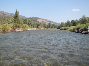
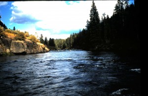
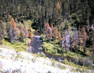
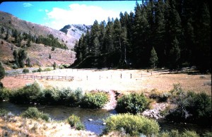
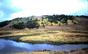
Whether you intend to visit this area or if you reside nearby, put the Grey’s River on your “have to try” list for next August and/or September.  Without a doubt, this western Wyoming river is one of the most beautiful high country rivers on earth.  Mostly of moderate gradient,  it flows mainly through pine forests but has some meadow reaches especially in upstream locations.  Once you get to Alpine Wyoming via either US highway 89-91 or US Highway 26, look for the Grey’s River Road heading east out of  “downtown” Alpine.  If you need a Wyoming license, fly-fishing gear, accommodations, or a good meal, Alpine can serve you well.  Back to the Grey’s River road.  Just the drive along it is worth a trip, and not having a good camera in possession is a tragedy.  For better than forty miles the Grey’s River Road parallels the river which at times is a stone’s throw away, then other times out of sight.   It is one of the better maintained gravel roads anywhere.  Along the road, mostly in its middle reaches, are some of the best US Forest Service campgrounds that can be found.  These make  great locations for anglers wishing to stay within casting range for days to enjoy fishing the river.  With exception of a few large ranches, the river courses through Bridger-Teton National Forest.  Thus access is not  problem.

The Grey’s drains the country between the Wyoming Range and the Salt River Range.  It’s beginnings are above elevation 6000 feet and no where is it below 5000 feet.  All this makes it a run-off stream of major proportions.   That’s why we cannot recommend fishing it until around late July in normal run-off years.  So let’s look at what this river offers with respect to fishing.  Snake River fine spotted cutthroat trout and mountain whitefish are the natives.  In the lower reaches one can encounter a few brown trout.  I use to believe that a sixteen inch cutt would be a braggin’ fish from the Grey’s. Was I ever wrong!   After concentrating a few years back on some undercut banks  with ant patterns, I nailed a couple of eighteen inch guys.  LeRoy, one of my fishing buddies did even better by fooling a twenty-two inch beauty.   Another prime place to concentrate attention would be where willows overhang a deeper run.  Fish residing here have “double cover” from depth and the overhang.  So laying here looking for drifting food items gives them comfort.  If you fish early in the late July time frame, you may see golden stoneflies emerging and cutts sipping them.   About the same time PMDs will begin a summer-long emergence and attract fish with their activity.  Afternoons will be the best time to enjoy the PMDs because,  as with all  “non-tailwater” high country rivers, time is required for water to warm up to their activity levels.  Caddisflies are plentiful all along the river, and some late afternoon swarms  can invade your eyes, ears, nose, and throat.  In the September time frame tricos will make for some morning fishing, but generally afternoon to early evening  are the best times for dry fly fishing.  Presenting nymph patterns can be good throughout the day.

Here’s a couple of thoughts to consider for the Grey’s River.  Below the Little Grey’s River confluence the river flows at a higher gradient through a canyon beloved by local kayakers and rafters down to near the confluence with the Snake River (beneath the topmost part of Palisades Reservoir early in the season).  Further upstream above the Murphy Creek Bridge fishing is permitted with artificial flies and lures only.  Throughout this reach the river can be waded with care.  The bottom consists mostly of rocks and cobbles. You might encounter a few drift boats or rafts on the river above Murphy Creek bridge, but that is only a once in a while happening.   Afternoon thundershowers are always possible here, and heavy ones can discolor the river to a coffee and cream color.  But normally the Grey’s River runs as clear and sparkling as any stream can.   If you decide to give the Grey’s a try, don’t forget that camera!

Share

Big Lost River

Have you seen Tim’s recent Big Lost River contribution to our fishing report? What he offers is typical for fishing success this time of year on the river downstream of Mackay Dam.  Midge activity and an increasing chance for BWOs appearing as we advance into early spring can make for great winter fishing.  Pick a blue-bird day, string up your four- or five-weight system with a floating line,  and bundle up for a most enjoyable time.  At the time of this writing flows are about 111 cfs out of the dam thus making for easy wading.  That’s typical of flows now as water users begin storing water in the reservoir for the upcoming agricultural season.  Increases to around 200 cfs are possible, but if anything such an action gives fish more overhead cover thus reducing their skittishness.  Right now snow depth is not much along the river below the dam, so access is easy.

In general fishing success  this time of year can be more reliable than during the irrigation season when flows out of Mackay Dam can vary up and down abruptly at times putting fish down for a few days.  The Big Lost River Valley below the town of Mackay relies heavily on agriculture for economic well being, and the demand for water at critical times during the growing season takes priority over any recreational use.  At the end of the agricultural season flow out of Mackay Dam is again reduced as  storage in the reservoir above begins, and fishing success once again becomes more consistent.  So even though great fishing can be had during the summer months, especially when golden stoneflies or flavs are active and terrestrial insects populate banks, it is wise to watch for any abrupt changes in flow.  With reduced flows late in the irrigation season a real feature on the river here is the morning trico emergence.  That brings fly-fishers from all points to enjoy resulting activity.  After tricos wane, it is back to the autumn midge and BWO activity much like the current late winter-early spring activity.  Then as during this time of year it is not a bad idea to have a streamer or wooly bugger pattern along  to try for some of the lunker rainbows that sulk in deep holes and undercuts.

Just below Mackay Dam and around the campground there is good access to the river.  Remembering that you are with in legal actions by staying within the high water level of the stream bed, you can fish anywhere.  Downstream, closer to town, private land prevails and some land owners discourage access. Others, however will grant access to those asking with a diplomatic approach.  I recall an incident decades ago on the river that guaranteed me access over a piece of private land. This happened below town, but likely remains a good strategy.  We had asked for permission to access the river to end a float trip further down the valley.  We were given reluctant permission.  We put in at the Darlington Bridge with most of the trip going through private land.  During the way we picked up all kinds of garbage and offal.  When we ended the trip the land owner came out of the field he worked in. When he saw the load of garbage we had, he asked if we had picked it up along the river in his property.  To our affirmative answer he offered; ” If you did that for me, you can come here any time you want to fish!”  Another incident got me trespass permission just outside of Mackay. We were within the high water level of the river, but the observing land owner  reminded us to stay within or we would be trespassing.  Luckily I tied into and landed a rainbow a bit under twenty inches as that land owner observed.  On reviving the gorgeous rainbow and releasing it, the landowner offered “That’s great!  Now I can enjoy that fish. C’mon back any time you want to fish here.”

Most folks in the valley want you to enjoy the exceptional fishing the Big Lost River offers for miles below Mackay Dam.  Your visit has economic value.  There is our usual stop for breakfast or dinner at one of the fine restaurants in the valley, and we do the same at C-stores for a lunch and liquid refreshment.  If you are coming from afar and wish to fish a number of days on the river, motels or B&Bs here will welcome you, especially this time of year when tourists are few.   So consider a visit to this unusually productive river before irrigation flows make it tougher to fish.


Share

Beula Lake

Beula Lake

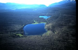
See that lake in the foreground of the “lookin’ south” areal  picture above?  That’s Beula Lake in the southwest area of Yellowstone National Park.   It is also one of the Park’s largest lake (a bit over 100 acres)  hosting Yellowstone cutthroat trout as the sole salmonid.  You cannot say that about larger Park lakes such as Yellowstone and Heart because they also host lake trout.  Trout Lake also hosts cutthroat-rainbow hybrids.  If I were to take a fly-fisher asking to catch cutthroat trout somewhere, especially in a back country setting, Beula Lake would be a top candidate for catching one.

Again, let’s look at the  picture above.  The trail head to Beula Lake is on the Ashton-Flagg Road at the east end of Grassy Lake Reservoir. You can see the trail’s trace towards the right through the skinny jackpine forest in the above picture. It ends at the southwest corner of the lake, a distance of 2.75 miles.  The first half mile from the trail head is uphill, but the rest is flat until you drop about 100 yards to the lake. There is a way to avoid this uphill pitch, but it is best described here in the shop.  That’s Fall River coming  into the southeast side of the lake. Fall River exits the lake at the northwest corner cascading down to flow through the first of stair-step meadows on exiting the Park and on into Idaho.  The elevation here is almost 7500 feet, so being in reasonable shape for the walk is advised.  There are three primitive campsites along the west shore of the lake.  Any one  of these can be used for an overnighter through the Park’s back country reservation system, but a day trip is totally practical.   Now let’s talk fishing.

The season here begins as soon as the USFS opens the Ashton-Flagg Road to traffic. That means after the road is dried. This is big snow country, so opening usually happens late in  June.  Much of Beula can be fished from the shoreline.  Just follow the fisherman trail around the lake to one of the several locations with shallow wading and allowing  back cast room.  Waders help, but are not necessary.  Beula cutts are not particular; any of your favorite small or medium sized  bead head nymph or leech patterns will attract cutts averaging 10-16 inches, but ranging to a bit over 20 inches.   A floating line and nine foot leader with  3-4X tippet  is all that is needed for presentation.  Damselfly action can be expected by the end of June, and speckled duns begin emerging in July.  So life cycle patterns for these two insect types work well any time, and the gulper fishing when they emerge can be terrific.  I’d mentioned wading as being effective for Beula, but if you are in good enough shape to pack a float tube in, you will have even better fishing.   Insulated waders may be best  for the water temps in the high fifties in degrees Fahrenheit.  Get  in front of the lily pad beds and pitch flies back towards the lilys or go to the inlet for non-stop action.  Thirty to forty fish days are common this way.  Again, going to the picture above, you can see Hering Lake  just to the south of Beula. You will need a float tube to fish Hering effectively, but your reward can be cutthroats ranging  to over four pounds.  But that is not every year.  Hering is not as hospitable as Beula, and trout get trapped in it when water connecting the two lakes recedes in springtime.  Some years only a few fish get trapped in Hering,  but competition is lower here , so they grow to larger sizes.  By September another food form is important on these two lakes.  That would be from the ant swarms that frequent the area.  When they fall in good numbers onto the lake surfaces, trout key on them with enthusiasm.  Around the end of September to the first of October the season begins ending here.  That is mainly because of weather.  Rain or snow storms can make the Ashton-Flagg Road tough for other than four-wheel drive vehicles, but when blue bird days extend into October, Beula (and Hering) can be spectacular fishing.  Just keep an eye on the sky for a change in the weather.  Any time you venture here bring potable water, ultra violet protection, and a reliable raincoat.  You will be for a unique and great back country fly-fishing experience.

Share

Damage Potential to the Henry’s Fork at the Grandview Access

Anglers treasure the reach beginning just below Lower Mesa Falls Campground and ending at the Stone Bridge below the Warm River confluence. Waters of the reach host bountiful rainbow and a few brown trout with individuals ranging to several pounds. During springtime large stonefly emergences one of the most popular float and fly-fish trips on the Henry’s Fork is through here. From here also begins a water trip to experience one of the most remote reaches of the Henry’s Fork. This reach of the Henry’s Fork is also much valued by wildlife photographers, rafting enthusiasts, and sightseeing tourists. For several decades, beginning in the mid twentieth century, its use has been a significant part of Fremont County economy. Users rent lodging and vehicles, hire guides, and patronize eateries and other retail outlets within the County. Access to float the river here begins just below Lower Mesa Falls Campground and requires portaging boats, rafts and such for a few hundred yards down a steep and erosion prone slope. Through decades of use over multiple descending routes the slope has suffered erosion to the degree that sediments from it threaten to enter the river to foul water quality and fish habitat. Finally observing damage to the slope through portaging all types of boats downward over these routes, but realizing the public popularity of its use, the United States National Forest Service (USFS) studied potential here for environmental impact. Results of the study indicated that a trail down the slope, not to quicken descent, but to establish a single pathway for portaging soft-sided boats only will minimize chances for sediment eroding into the river. Hard sided boats, usually weighing much more and being more rigid than soft sided boats, dig deeper into the slope and move down it more quickly thus increasing potential for erosion. The USFS therefore established the lowest impact pathway with maintainable water bars down the slope to the river. The USFS also provided soil for plant material to re-vegetate the slope that would provide a natural barrier for impeding sediment from entering the river. The USFS will monitor the effects of use on this pathway on the slope. Although this is a hazardous route to the river and not advocated by the USFS, plans are to keep it open after discussions with fishing guides and other users. Despite establishment of the restrictive trail down the slope, it now appears that some users are pioneering trails to portage hard sided boats down to the river. Such actions make increased potential for sediments to enter the river. In an effort to prevent misuse down the slope, the Snake River Cutthroats and the Upper Snake River Fly-Fishers of Idaho Falls and Rexburg respectively are combining to establish signing at the top of the established pathway to indicate that restrictions are in place and the reasons for them being established. Members of these clubs and Trout Unlimited encourage other anglers and users to honor the restrictions here and to assist the USFS in policing the established trail. Any observed violation of this trail to the river should be reported to the USFS Ashton District Ranger Station: 208-652-7442.

Share

Aldous Lake


Aldous Lake

 One August day about twenty years ago I traveled with wife Carol and Jessie our Lab to the Aldous Lake trail head north of the Clark County ranching community of Kilgore.  Our plans were to spend the night away from civilization, relax, and do some hiking and fishing.   We packed overnight camping gear, float tube, waders, fly fishing equipment, and enough for a few good meals during the stay.  On arriving at the trail head around late morning, I curiously noticed a  parked sedan.  It sported Utah registration plates and rental car identity.  We geared up, hiked the mile and a quarter up to the lake and saw a lone float tuber on it.  We set up camp and noticed cutthroat trout rising as expected to emerging speckled duns on the lake.   I donned waders, strung up with a speckled dun emerger pattern, hopped into the float tube, and paddled out on the lake.  Catching was easy, and I began comparing the experience with the lone float tuber.  To my surprise he responded in a thick New York accent.  How in heck did he find this place!  So I had to ask how because this remote little lake rich in cutthroat trout is off the beaten path.

” I came to Idaho to fish the Henry’s Fork, but crowds around the Last Chance-Harriman offered little solitude.  So I stopped at Mike Lawson’s Henry’s Fork Anglers asking for fishing with solitude.  They suggested this place, so I rented a float tube and fins, picked up some speckled dun patterns, and here I am.   I got here a few hours before you and have had some of the best trout fishing of my life.  Problem is I gotta leave soon to take this gear back to Mike’s, drive to Salt Lake, turn in the car, and catch an early morning flight back to LaGuardia.  Sad to be leaving such a great time.”

Having a great time catching cutts ranging to around twenty inches was no problem that day, and doing so without any other anglers around was a real treat.  Aldous Lake, no more that a pond, offers that experience if you are willing to pack a float tube and waders for a mile and a quarter up a well-maintained, non-motorized trail. You get there after traveling Interstate-15 to Dubois, Idaho. There you exit and go east on county highway A2 to Kilgore.  From there you hang a left ( go west) to the nearby East Camas-Ching Creek Road, take a right and follow the road to its end at the trail head.  From the Island Park area, take the Yale-Kilgore Road west to Kilgore.  After a short but exhilarating hike, you come to the lake on the south side of the Centennial Range, and just below the Continental Divide.  Yellowstone cutthroat trout inhabit the lake.   Some limited spawning occurs in the outlet, so from time to time IDF&G enhances their population.  All you need to enjoy these cutts is a floating line, long leader, and reasonable physical condition.  If you choose to wade, bring your roll casting skills because most of the shoreline is forested.  But a packable float tube gets you onto the lake to enjoy cruising cutts picking off emerging damselflies in late June or speckled duns emerging from late July into September.  The same cutts will take small leech or scud patterns just about any time.   The mostly uphill walk to the lake pretty much guarantees only a few anglers being present, and even fewer will pack a float tube.  Bring potable water, a shielding hat, and sun screen.  You will be in for a near wilderness experience.

i

Share

Shoshone Lake

Shoshone Lake


It’s the largest roadless lake in the lower forty-eight states. That is thanks to being in Yellowstone National Park.  At a bit over twelve square miles it is a distant second in size of Park lakes to Yellowstone Lake.  Historically barren of salmonids until the late nineteenth century, it was stocked with lake trout from the Great Lakes and with brown and brook trout.  So well did these adapt that for a while a commercial fishery operated on the lake to supply Park hotels with table fare.  This activity was stopped when fish stocks in the lake diminished early in the twentieth century.  Later, power boats were eliminated from the lake  in an effort to maintain its pristine character. That restriction, thankfully, remains to this day.

Because Shoshone is roadless, trails and a river trip up its outlet Lewis River are the only means of approach. The water trip requires crossing Lewis Lake and traveling up the river in a non-motorized manner.  Several trails go to the lake,  the longest being from Bechler Ranger Station or even Old Faithful,  trips of over twenty-five  miles to Shoshone’s west end.  To the east end and outlet, a trail begins just north of  Lewis Lake, follows along a ridge above the river and ends near the Shoshone Lake Ranger Station, a distance of about five miles.  The shortest trail to the lake begins off the Old Faithful-West Thumb Junction road and follows Delacey Creek to the lake, a distance of three miles.  This is the easily traversed Delacey Creek Trail which leads close to one of the best fishing spots ( see the above picture) on the lake. Only problem is the angler needs to pack a float tube  or similar floatation device to get out in the lake to realize the superb fishing  at this location. Shoreline fishing is also possible at this location, but a good day doing so might result in on one or two fish. Out in the lake here, especially about one hundred yards, along the eastern shoreline,  are weed beds which host food forms such as leeches, scuds, aquatic insect life cycle forms, and forage minnows. These weed beds therefore attract numerous foraging  juvenile lake trout, brown trout and relatively rare brook trout.  All the visiting fly-fisher must do is paddle out to these and use a full-sinking line and moderately strong (2X) nine foot leader to get down to these beds, usually around fifteen feet below, with patterns that imitate these food forms, and action will come.  Action comes from juvenile lake trout, usually measuring between seventeen and twenty-two inches, and some of the most beautiful brown trout alive.  These range up to twenty-five inches and fight as well as their lower elevation brothers and sisters.  When usual wind is not roughening the lake surface, fish can be seen around the weed beds in the ultra-clear water.

There is also another “must” for fishing the lake in this manner: insulated waders or enough layers of clothing underneath waders to keep body parts in the forty-five degree water warm enough to function.  A good shielding hat for sunlight protection and a raincoat in case of afternoon thundershowers should be packed.  While on the lake mosquitoes are not pesty,  but they can be on the trail.  So a repellent high in DEET content is recommended.  If one packs food, this must be hung in trees to keep away from bears.  Better yet, take  food items out onto the lake.  Bringing potable water is not required, but is recommended.  A current Park fishing license is required, and so is a non-motorized  ($10 in 2012) boat permit for using a float tube or similar device.  Both permits can be obtained at Park ranger stations and at the West Yellowstone Visitor’s Center.  Fishing Shoshone Lake in this manner makes for a full day, and plenty of excellent restaurants  in the Park at such as Old Faithful and Grant Village, outside the Park in West Yellowstone, along the highway to Jackson, or in Jackson itself will beckon.  There is also the option of reserving one of a few primitive  campsite near this part of the lake for an overnight stay. Either way; day trip or overnight,  Shoshone Lake offers a true wilderness experience with the only motorized sound coming from an occasional overhead airplane.

Share

Fall River


Fall River in Isolation


That picture above looks like Box Canyon on the Henry’s Fork,  doesn’t it?  It is taken on Fall River just a few miles below the Idaho-Wyoming border.  To be exact, it was taken between the Boone Creek confluence and the Yellowstone Canal Diversion, the farthest upstream  irrigation take-out on the river.   Fall River in its reach from Cave Falls to the Kelly Bridge,  the furthest upstream crossing a few miles below this diversion, is mostly isolated.  You will not see drift boats here.  There are no developed launch sites upstream of the picture location, there are at least two waterfalls above that would make a portage necessary, stretches of dangerous water, and no developed boat access points in the area of the bridge.   Once in a while a kayak or raft launched at Cave Falls Campground or at the end of the Steele Lake Road may go through this part of the river, but there are some walk-in access points.   Most are off the Cave Falls Road, but one of the most convenient on public land is off the Ashton-Flagg Road, and it brings one to the Boone Creek confluence.  Look for it after passing on the west end of the road through the extensive quaking aspen grove straddling the Targhee-Caribou National Forest boundary.  It will be the first gated road on the left (north) side after passing the  Squirrel Creek Vista.  Park without blocking the gate and walk the road, a bit more than a mile, to its end near the confluence. The last few yards are a scramble down a steep, but negotiable slope to the river edge.  You will be in Idaho here, but much of the river above is  in Wyoming.  Most folks think of the river here as one long set of rapids holding only small fish.  Not true: within this reach of the river are a number of  large, deep holes that host cutthroat-rainbow trout in sizes that would honor any regional river.  There is one at the Boone Creek confluence, and another about a half mile below.  That one is pictured at the base of the rock outcrop in the picture above.  Walk upstream above the confluence, and you will see more such holes.

The problem with fishing here is the treacherous nature of Fall River. It is notorious for a slippery, rocky bottom. In the early season, about mid June when large stoneflies are emerging, the river likely holds a  high volume of run off.  Safe wading the river then is only for the strong, vigorous angler.  Crossing the river is not recommended for anyone during this time, but if one can approach the water around these big holes, a dry adult stonefly pattern or a deeply presented nymph has a chance of bringing up residents ranging to well over twenty inches.    By mid summer run off is gone from the river (so are mosquitoes!) making it safer to wade the uneven and tricky sub surface. Rely on felt soles and a wading staff.  At this time, and well into September, terrestrial patterns, especially large grasshopper or attractor patterns are the best way to get the interest of the larger trout holding in the big holes.  Large stonefly nymphs and streamer patterns or fly rod jigs will work sub surface.  Because of the isolated nature of the river here and that cell phone service may not get into the canyon, it is a good idea to inform someone that you will be fishing here.  Carry potable water, and be aware that bears are in the area, especially during the August berry season.  If you seek seclusion, wonderful scenery,  a good chance for seeing wildlife, and are in good physical shape, this part of Fall River could end up as a destination for you.

Share

Robinson Creek


Robinson Creek


How many streams can you visit and have a chance to catch five different salmonids?   Robinson Creek is likely one of very few in the Greater Yellowstone Area.  It hosts brook, brown, cutthroat, and rainbow trout as well as rocky mountain whitefish.  Robinson Creek flows just inside the west boundary of Yellowstone National Park before turning southwesterly into a deep canyon to exit the Park and flow eventually into Warm River in the “Three Rivers” area  about a  mile above the Warm River-Henry’s Fork confluence. It is that picturesque stream on the right when you descend from the south on the Mesa Falls Scenic Loop into that area.  Soon you cross it just above its confluence with Warm River.  In this area it is mostly on private land, but there are two good access places on public land much further upstream.  These are off the Cave Falls Road, also known as the Green Timber Road.  From Ashton take the Mesa Falls Scenic Loop (State Highway 47)  east about five miles, and turn east on the Cave Falls road to county road 4500 North.  Turn left (north) there and go past Teton View Estates.  The pavement ends and you drop into Robinson Creek’s canyon.  Cross the creek and ascend the other side of the canyon where you will see some pull-outs.  Robinson Creek is on your right down a fairly steep, but negotiable grassy bank.  The picture above shows this location.   The gradient here is moderate, but a series of log plunges established  by IDF&G supplement holding water.  Boulders, deeper runs,  and downed timber also provide cover to this freestone stream.  Trout here run from juveniles to surprisingly large sizes.  Further east on the Cave Falls Road, just after the Rock Creek crossing, take a left to access another location on Robinson Creek.   Go about two miles north past the LDS Church girl’s camp to a turn-around.  Robinson Creek, easily approached, flows through the narrow meadow below.   You can also access Robinson Creek in Yellowstone Park off the Fish Creek Road east of Warm River and after a four mile walk up the West Boundary Trail from Bechler Ranger Station.  Between these locations the creek can be accessed near Horseshoe Lake if one does not mind a bit of rock scrambling down the canyon.  But the two locations described off the Cave Falls Road provide the most interesting fishing.   So do locations into the canyon off  Teton View Estates if you can get permission to access across the private lands there.  Reasons are that the creek is larger at the locations described off the Cave Falls Road.  Another is that as one goes upstream, cutthroat and brook trout dominate increasingly over brown and rainbow trout and whitefish.  Robinson Creek is a runoff stream with origins on the west side of the Madison Plateau in Yellowstone Park.  Thus, the early season on it varies depending on snow melt.  But usually by the first of June it is worth fishing, and wading become less perilous.  The first event of interest is the giant and golden stonefly hatches which ascend the stream.  This is followed by hatches of green drakes and PMDs.  Caddis activity along the stream can be relied on during afternoons throughout the season.  By mid July terrestrial insects become increasingly important food forms for trout, and favorite terrestrial patterns work very well.    Wet wading is also more attractive by this time, and mosquitoes are mostly gone.   A four-weight system using a shorter (7′-7’6″ ) rod is ideal for fishing this stream.  A floating line is all that is needed to fish the stream in these locations given and to present bead head nymphs of small to medium sizes as well as floating patterns.   A 4X tippet  provides enough strength to hold fish here.  Bring a good supply of potable water, sun screen, and protection from the sun.  Light weight rain gear is also recommended.  Late afternoons and early evenings are a particularly interesting time to fish this stream.  Surface activity is at its peak and decreasing air temperatures seem to cool the canyon to comfortable  levels.

Share

Bear Creek

Bear Creek

In his writings Ernie Schwiebert devotes quality efforts to “The Song of the Small Stream.”  He did so for good reason.  In so many ways small streams offer an escape from the demands that larger waters place on us for fishing success.  Small streams are certainly more easily approached.  They lack the physical perils of large rivers.  Their smaller scope results in an ease in determining where fish may reside at a certain time.  And resident fish mostly seem less selective here than in the larger waters.   Who among us does not savor the experiences large rivers offer?  But this makes them more visited, and therein lies another asset to smaller waters; a better chance for solitude.

The Greater Yellowstone area abounds in high quality small streams.  So where does one start to discuss these?  We begin with Bear Creek, a tributary to Palisades Reservoir on the Snake River and straddling the Idaho-Wyoming border.  Because of  an essentially Yellowstone cutthroat trout only population, it is a rarity among streams.  Thus catch and release fishing applies.  It flows into the aptly named Bear Creek Arm on the southwest side of  the reservoir.  From eastern Idaho’s Snake River Plain, one travels east on US Highway 26 to just below Palisades Dam, crosses the South Fork reach of the Snake River here, then follows the USFS signs eight miles to the Bear Creek estuary. With spectacular scenery it’s a beautiful eight miles, certainly worthy of a high resolution camera.   At the estuary a former campground serves as an ample parking area with the Bear Creek trail head at the upstream end.  From here the trail parallels the creek for several miles.  The creek remains mostly in view along the trail.  It’s a freestone stream of moderate gradient but with slower portions and abundant deeper holes and runs.  During springtime this creek  is a significant spawning stream for Yellowstone cutthroat trout.  In good water years many of these fish remain in the creek’s quality water,  perhaps into September.  These fish range to good sizes with a few specimens exceeding twenty inches.   But mostly this stream rears fish which eventually head for the reservoir below.  Look for the larger fish to reside in the abundant deeper holes and runs.  Be particularly aware of deeper water sheltered by overhanging willow and grasses.  Such will shelter  foraging individuals.   So do the newer beaver ponds located mainly above the Current Creek Guard Station, a holdover from days when forest rangers patrolled the area on fire watch, to monitor wildlife situations, and livestock impacts.   The station is nearly two miles upstream from the trail head, and is a good photography subject.  See it situated in shadows on the other side of the creek in the above photo.  On the opposite side of the creek  is potable spring water piped to serve  guard station occupants.

The scene in the picture above is mid summer when Bear Creek is at its most interesting fishing.  Judicious wet wading is appropriate, but no more than hip waders are necessary.  A few PMDs will come to the surface in afternoons during this time.  Later in the day abundant caddis appear.  But the most enjoyable way to encounter resident cutthroat is through presenting terrestrial insect patterns.  Keep the sun to your back as much as possible when on the stream.  Drift your patterns beneath overhangs above water of sheltering depth.  Test the top ends of deeper holes and banks and inlets of the beaver ponds.  Soft hackle flies make good presentation alternatives when aquatic insects emerge.  So do a variety of nymph patterns (size 10-18), with and without a bead.  A three or four weight set-up with a floating line is ideal for presenting flies here, and a long fine leader (4x-5x) is a must because of the ultra clear water.   A good strategy is to begin fishing around mid day when water temperatures arrive at levels suitable for insect activity.  Continue fishing to around six in the evening.  The walk out will add to one’s appetite for an excellent dinner many of which are offered in restaurants and fishing lodges along Highway 26.

Share

Upper Blackfoot River


             Upper Blackfoot River


 The Blackfoot River Reservoir divides the Blackfoot River in two portions in more ways than physically.  Below the reservoir it flows into a deep canyon not always accessible. Above the reservoir the river trends through stair-step meadows and slower reaches punctuated by what locals rightly label as “narrows.”   Each section has its own particular beauty and character. Throughout, this beautiful river is a stronghold for Yellowstone cutthroat trout with a smattering of rainbows and brook trout.

For now, let’s target the upper river.  The season here opens on July 1st each year to minimize interference  to spawning cutthroat.  For sure, the most attractive location to fish the river is on IDF&G’s 1800 acre Blackfoot River Wildlife Management Area, formerly the Stocking Ranch.  The river begins at the confluence of Lanes and Diamond creeks at the top of the Wildlife Management Area.  In the Management Area it winds, six miles in all, through reverse bends in a vast meadow similar in character to the upper meadows on Yellowstone Park’s Slough Creek.  Pine forests and quaking aspen groves occupy surrounding mountains.  It’s a setting of beauty hard to exceed, and anglers are always few in number.  The most direct route to get to this part of the river is from State Highway 34 north out of Soda Springs, then east on the Blackfoot River Road on up through the “Upper Narrows.”  On exiting the narrows one enters the Wildlife Management Area.    Pull-outs are located at the top, middle, and bottom of the Wildlife Management Area.  Just where the narrows open to the meadows is a well-maintained USFS campground.  Take a look at the mid-September picture featured above.   What fly-fisher would not savor such water and surrounding country!   Each bend hosts a school of cutthroat trout.  Waist high grass and scattered willows provide overhead cover for the meandering stream, and within are cutthroat ranging to trophy sizes.  By mid summer, these host a terrestrial insect population population second to none.   What a great river to test those storied terrestrial patterns!  From the river itself a small brown drake emergence  begins evenings soon after the  July 1st opening.  Emerging PMDs compliment the drakes.  A very few golden stoneflies and afternoon caddisflies round out the major aquatic insect emergence, except for late season BWOs.   So dry fly fishing is a  most enjoyable way to fish this section of river which weeds up in a manner similar to the Henry’s Fork in Harriman State Park.   But nymphs and small leech patterns produce along undercut banks, between weed beds, and deep holes here.  A four or five weight rod is ideal for presenting all these and a long, fine leader is necessary for dry flies.  So are rain gear, sun glasses, a shielding hat, and sun screen.  Tank up on water before venturing out, and bring enough to stay hydrated as no potable water is available except in the campground below. This is high country, hovering just over 6000 feet in elevation.  Afternoon thundershowers are common, and evening mosquitoes can be expected until early August.  By Labor Day evenings cooling enough to frost are possible, but the terrestrial insect population remains strong.  After mid- September a killing frost can happen any time.  By then, however, most of the locals are hunting and the non-locals are back to work or school.   That means you might be the only one fishing on the Management Area.

Share